How to Read a Travel Map Without Mistaking It for the Place
Learn how to read a travel map, choose the right kind, and spot its omissions so you can orient yourself without mistaking the page for the place.
The most common mistake with a travel map is treating it as a smaller version of the place, then following its lines as if they tell the whole story. That can send you toward a closed path, hide a steep climb, or leave you wondering why a neighborhood feels nothing like its visitor map. To read a travel map well, use it for the questions it can answer and check the rest against the street.
What kind of travel map are you holding?
A street plan prioritizes roads and intersections. A transit map clarifies connections, often simplifying the actual distance and shape between stations. A topographic map represents elevation and terrain; a visitor map may instead foreground museums, scenic walks, and places to eat.
Start with the title, legend, scale, date, and publisher. These details explain what the map was made to show. A hiking map may mark paths that a city visitor plan omits, while a transit diagram may rearrange stations to make connections easier to follow. If a map has no date or legend, treat unfamiliar symbols and missing features cautiously.
Travel maps have long served different audiences. Navigational charts, boundary maps, and pocket plans for visitors reflect distinct needs and authorities. That history matters because a map is not a neutral window: its maker chooses what to name, emphasize, simplify, or leave out. The useful question is not whether a map is honest or dishonest, but what purpose shaped its view.
How do you orient yourself on a travel map?
Find a feature you can recognize on the ground: a river bend, a prominent square, a railway station, or a coastline. Use it to locate yourself, then check the map’s orientation. North may be at the top, but a diagram can turn or simplify the layout, and a mobile map may rotate as you move.
Read the legend rather than guessing at colors. A blue line might indicate a river, a transit route, or a walking path, depending on the map. A dotted line could mark a trail, a boundary, or a suggested itinerary. The legend explains the publisher’s symbols; the landscape helps you decide whether they remain useful on the ground.
Scale matters, too. A close-up street map can help with a turn but hide the wider structure of a neighborhood. A regional map makes distances and connections easier to compare, while obscuring the detail needed to find a small lane. Switching between scales is more sensible than asking one map to do every job.
What can a travel map reveal about a place?
Maps invite comparisons. A river, ridge, road, or rail line can show how a settlement relates to its setting. A cluster of civic buildings may indicate where public institutions gather; a concentration of hotels can suggest which areas are organized around visitors. These are starting points, not verdicts about the people who live there.
Names carry clues as well. Street names, neighborhood labels, and local-language spellings show which versions of a place appear on the page. A visitor map may use a familiar name while signs nearby use another, or give more prominence to administrative districts than to names residents use. Keep the labels beside what you encounter rather than assuming that one cancels out the other.
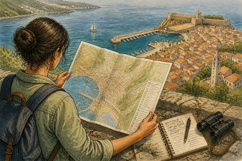
Imagine you have a printed plan of a coastal town that highlights the harbor, old fort, and promenade. You use the harbor to orient yourself, then notice that the plan gives little space to streets behind the waterfront. You walk one block inland, compare the street signs with the map, and find a school, a small park, and shops serving the neighborhood. The result is a clear distinction: the map works as a visitor’s orientation tool, but its frame does not describe the whole town.
What does a travel map leave out?
A map cannot give every feature equal space, so omissions are part of its design. Small paths may vanish from a road map. Private spaces, informal routes, temporary closures, steep changes in elevation, and the feel of a busy intersection can also be hard to represent. Some details fall outside the map’s purpose; others may have been unavailable or simply not selected.
Ask who made the map and who is expected to use it. A tourism office may emphasize sights and visitor services. A transport agency may focus on routes and stations. An official boundary map may show administrative divisions clearly while giving little attention to how residents understand their neighborhood. The map’s silences do not prove a particular intention, but they can suggest questions to carry with you.
It is not worth trying to infer a community’s character from a handful of symbols, or treating every omission as deliberate concealment. Notice what is shown and what is not, then consult another source or observe the place directly if the difference matters.
How should you use a map while walking?
Use the map to choose a direction, then compare it with what you can see. Check a street sign, a river crossing, or the shape of a square against the page. If the surroundings do not match, stop and reorient rather than pressing on because the line looked persuasive. On a digital map, check whether the display is rotating and whether it is set to north-up or direction-of-travel.
For a longer outing, mark a few reliable reference points: where you begin, a junction or landmark, and a place to reassess. A paper map makes the broader layout easy to see at a glance; a phone can supply current location information. Keep the map suited to the terrain, and consider local conditions and access rules before choosing a route.
When a detail matters, compare sources. Set a printed visitor plan beside transit information, posted signs, or an official trail map. A second map may correct an outdated route, but it may have a different purpose and its own omissions. Agreement helps; it does not replace checking the place itself.
Which travel map questions come up most?
Why do transit maps distort distance?
Many transit diagrams simplify geography so riders can follow lines and connections without sorting through every curve. Use them to understand the network, then consult a geographic map or local directions when actual distance and street layout matter.
Is a paper map useful if I have a phone?
A paper map shows nearby landmarks and the wider layout together, and it needs no signal to display what is printed. A phone can help with current positioning, but its view may be narrow or depend on battery and connectivity.
Can an old map help me understand a place?
It can show which streets, names, and landmarks a mapmaker considered important at the time. Treat it as evidence of those choices, not as a current guide to access or conditions.
What should I do if the map and street signs disagree?
Give current posted signs priority for immediate directions, and check a local or official map if the difference affects your route. The discrepancy may reflect a changed name, a different language convention, or an outdated map.
What should you check before following a route?
Before setting off, make a quick comparison between the route on the page and the conditions you can confirm. Each check should lead to a decision, not merely another thing to worry about.
- Check the map’s date; if it is missing or old, use a current local or official source for closures, then choose a route that source confirms.
- Check the legend for the line you plan to follow; if the line is unclear, identify it with a second map before relying on it, or choose a clearly marked route.
- Check whether the route crosses a river, rail line, or major road at a marked crossing; if no crossing appears, look for a mapped bridge or underpass, or change the route.
- Check the terrain markings and contour lines where they appear; if the route crosses steep ground you do not want to tackle, choose a lower or flatter alternative.
- Check current signs at junctions; if a sign contradicts the map, follow the posted direction for immediate access and confirm the route with an updated source.
- Check whether your phone map is rotating or showing a different orientation; if its direction is unclear, switch to north-up or use a visible landmark to reorient before moving on.
Say you have a printed visitor map for a coastal town, and its suggested walk follows the promenade before turning inland toward a hilltop fort. You check the date and find it is not stated, then compare the route with a current official town map, which marks the upper path as closed. You look at the terrain symbols and see that a lower road reaches the same side of the fort; at the junction, a sign points to that road. You take the lower route instead. The decision is straightforward: the visitor map remains useful for the general direction, but the current map and posted closure determine which way to go.
When you fold the map or close the screen, keep one connection it made clear: how the town meets the water, how a road follows a ridge, or how several streets converge on a public square. Keep one correction, too, such as a changed route or a neighborhood name used on local signs. That comparison is the practical value of learning how to read a travel map: you gain direction without mistaking the page for the place.